
How to Get to Crested Butte: The Scenic Route Nobody Told Us About (Updated 2026)
The GPS chose the shortest route. It turned out to be the most beautiful drive of the entire trip.
Most people heading to Crested Butte from Denver or Breckenridge take I-70 west through Glenwood Springs and then south through Gunnison. It’s the fastest route, it’s all highway, and it’s fine. We didn’t take it.
Our GPS chose the route through Buena Vista, over Cottonwood Pass, and down through Taylor Canyon, and what was supposed to be just a drive turned into one of the most unforgettable stretches of the entire Colorado road trip. A mountain pass with deer standing by the road like cows on a Swiss hillside. A canyon we’d never heard of that stopped us in our tracks. And complete, total remoteness for two hours straight.
So here’s how to get to Crested Butte the way we did it, why I’d pick this route over the highway every time, and what you need to know before you commit to it.
Let’s get into it.
Short on Time
In a Rush?
Here are our favorite places to stay in Crested Butte
Old Town Inn
★★★
A great-value stay with free parking, a hot tub, and a complimentary shuttle to Mt. Crested Butte.
Check Rates*Advertising: affiliate links. No extra cost to you.
What’s In This Guide
How to Get to Crested Butte: Your Options
The Scenic Route: Cottonwood Pass and Taylor Canyon
The Fast Route: I-70 Through Gunnison
From Breckenridge to Crested Butte
Do You Need a Car in Crested Butte?
Get Ready for Your Trip to Colorado
Frequently Asked Questions
How to Get to Crested Butte: Your Options
Crested Butte sits at the end of a valley in the Elk Mountains, roughly four hours from Denver. There’s no highway running straight to it, no train, and the nearest airport with commercial flights is Gunnison, about 30 miles south. Almost everyone drives, and there are two main routes from Denver. One is fast and boring. The other is slow and unforgettable. We took the slow one both times.
Two Routes Compared
Fast route (I-70): Denver to Glenwood Springs to Gunnison to Crested Butte. About 4 hours, mostly highway, reliable year round.
Scenic route: Denver to Buena Vista to Cottonwood Pass to Taylor Canyon to Crested Butte. About 4.5 hours, mountain passes and gravel, summer and fall only. This is the one I’d pick every time.
The Scenic Route: Cottonwood Pass and Taylor Canyon
This is the route our GPS chose and the one I’d recommend to anyone visiting in summer or fall. It’s longer by maybe 30 minutes, but what you get in return is two of the most beautiful stretches of road in Colorado.
Cottonwood Pass: 12,126 Feet With Nobody Around
From Buena Vista in the Arkansas River Valley, Cottonwood Pass Road climbs to 12,126 feet with wide alpine panoramas and almost no traffic. It’s not one of the famous Colorado passes, and that’s exactly what makes it special. No tour buses, no crowded viewpoints, no Instagram lines. Just mountain air, golden slopes in fall, and deer standing by the road as casually as cows on a Swiss hillside.

Tip: Cottonwood Pass is seasonal and usually closes in late October or November. Check road conditions before you commit, especially after early snowfall.
Taylor Canyon: The Best Surprise of the Entire Road Trip
Nobody told us about Taylor Canyon. It wasn’t in any guidebook we’d read. Our GPS simply chose the shortest route from Cottonwood Pass to Crested Butte and sent us through it. Sometimes the GPS knows more than you do.
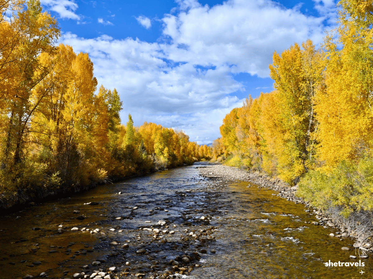
The Taylor Canyon along the Taylor River between Almont and the base of Cottonwood Pass was one of the most unforgettable stretches of the entire road trip, and we nearly drove straight through without stopping. Golden trees right at the water, a clear river winding through a narrow gorge, rock walls rising steeply on both sides, and complete, total remoteness. No crowds, no tourists, just nature in its most beautiful fall form.
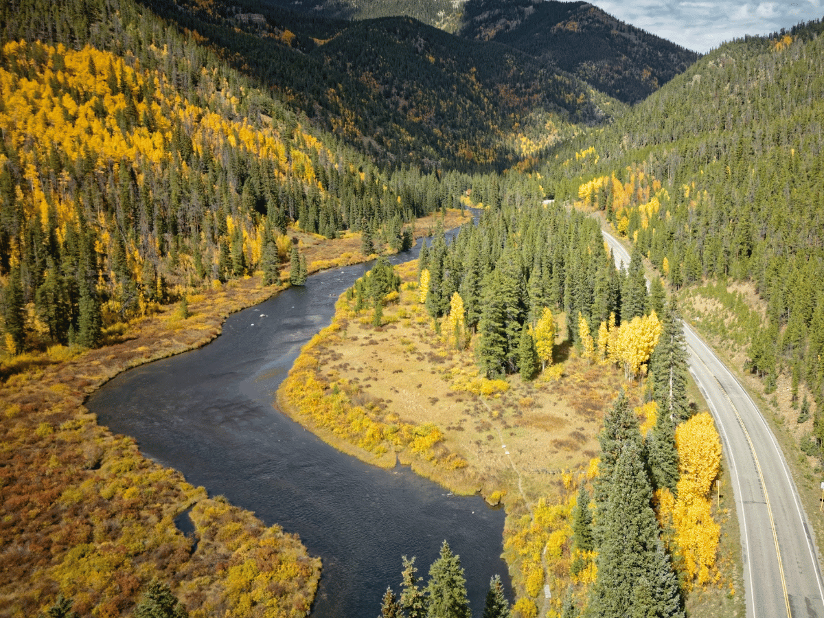
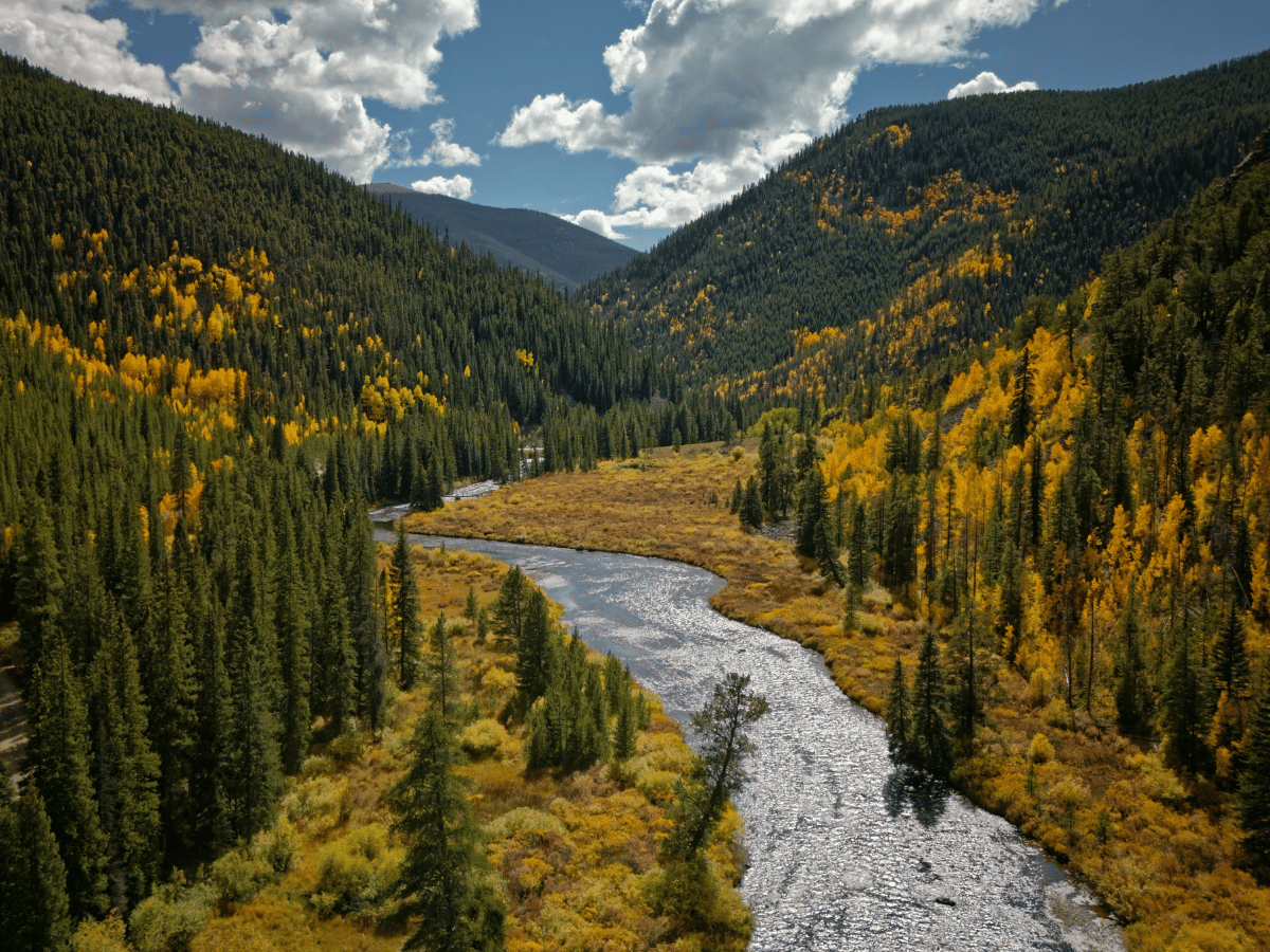
Taylor Canyon is one of those places you don’t plan and don’t forget. Beautiful from the first curve to the last, and a quiet promise to come back.
Tip: There are a few pullouts along the river, but no formal parking lots or facilities. Bring food and water, and stop whenever something catches your eye. In fall the whole canyon glows.
The Fast Route: I-70 Through Gunnison
The standard route from Denver goes west on I-70 through the Eisenhower Tunnel, past Vail and Glenwood Springs, then south through Gunnison on US 50 and north to Crested Butte. It’s about four hours, mostly highway, and it works year round including winter.
It’s the right choice if you’re arriving late, driving in winter, or just want to get there. But if the weather is good and you have daylight, the scenic route is a completely different experience and I’d pick it every time.
From Breckenridge to Crested Butte: The Route We Drove
If you’re doing the Colorado fall road trip and coming from Breckenridge like we did, the route south through Fairplay and Buena Vista is the natural choice. It connects Boreas Pass and Breckenridge with Cottonwood Pass and Taylor Canyon in one continuous drive, and every mile of it is golden in late September.
Budget about three to four hours including stops, and you will stop. The views through the Arkansas Valley alone are worth slowing down for.
► Read our full guide to Breckenridge in Fall
Do You Need a Car in Crested Butte?
For the town itself, no. Crested Butte is walkable, Elk Avenue is compact, and there’s a free shuttle between Old Town and Mt Crested Butte. Camp 4 Coffee, the restaurants, the galleries, everything is on foot.
For Kebler Pass, absolutely yes. The pass is a gravel road west of town and there’s no shuttle or tour bus running it. Same for the scenic route in: Cottonwood Pass and Taylor Canyon are only accessible by car. AWD is recommended for both Kebler Pass and the western side of Cottonwood Pass, especially after rain.
If you’re flying into Gunnison, rent the car there. If you’re coming from Denver, rent at the airport and drive up. Either way, book AWD for fall and don’t wait until the last week, because foliage season tightens the rental pool in this part of Colorado.
► Read our full guide to Crested Butte and Kebler Pass in Fall
► Read our full guide on where to stay in Crested Butte
Get Ready for Your Trip to Colorado
Book Your Accommodation
For Crested Butte I use Booking.com*. I also cross check on Hotels.com* and Expedia*. For cabins, check Vrbo*. Compare rates on Kayak*. I also check Agoda* when the big sites show sold out.
Book Your Flights and Rental Car
For flights and rental cars into Denver or GunnisonI compare on Kayak*. For the scenic route, book something with clearance and AWD. A standard sedan will struggle on Cottonwood Pass and Kebler Pass.
Book Tours and Activities
For guided hikes and fall foliage tours in the Crested Butte area, GetYourGuide* is where I look first.
Advertising: affiliate links. No extra cost to you.
How to Get to Crested Butte: Frequently Asked Questions
🚗 How far is Crested Butte from Denver?
About four hours by the fast route (I-70 through Gunnison), or four and a half by the scenic route through Cottonwood Pass and Taylor Canyon. The scenic route is longer but far more beautiful, especially in fall.
🚗 How far is Crested Butte from Breckenridge?
About three to four hours through Fairplay, Buena Vista, and Cottonwood Pass. There’s no direct highway between the two, which is part of what makes the drive so beautiful.
🚗 Do you need a 4WD to get to Crested Butte?
Not for the fast route via I-70 and Gunnison, that’s all paved highway. For the scenic route over Cottonwood Pass, AWD is recommended for the gravel sections on the west side. For Kebler Pass once you’re in Crested Butte, AWD is also recommended.
🏔 What is Taylor Canyon and is it worth the detour?
Taylor Canyon runs along the Taylor River between Almont and Cottonwood Pass. It’s one of the most beautiful hidden stretches in all of Colorado: golden trees along the water, steep rock walls, total remoteness. We found it by accident and it became one of the top moments of the trip. It’s not a detour, it’s on the scenic route.
✈️ Is there an airport near Crested Butte?
Gunnison Crested Butte Regional Airport (GUC) is about 30 miles south and has seasonal commercial flights from a few US cities. Most visitors fly into Denver International and drive up, which gives you the flexibility to take the scenic route and do the full road trip.
Final Thoughts on How to Get to Crested Butte
Taking the fast route to Crested Butte gets you there. Taking the scenic route changes the trip. Cottonwood Pass and Taylor Canyon turned what should have been a transfer day into one of the best driving days of the entire road trip. If the weather is good and you have daylight, don’t even think about I-70.
Check availability in Crested Butte here* and book early for fall. Happy travels.
Check Out My Other Colorado Travel Guides
Crested Butte and Kebler Pass in Fall: The Largest Aspen Forest in North America
Where to Stay in Crested Butte: Old Town vs Mountain Village
Breckenridge in Fall: Aspen Alley, Boreas Pass and Where to Stay
Rocky Mountain National Park 3 Day Itinerary: What I Loved and What I’d Do Differently
Colorado Travel Guide: Best Road Trips and Mountain Towns